Experts in the Philippines and people from the UN Food and Agriculture Organization are set to deploy drones for the purposes of agriculture across the country. However, some countries are now using drones to prepare themselves for major weather events and monitor big storms as they occur. One such place where drones watching weather and storms are being used also happens to be in the Philippines.
Drones Watching Weather and Storms Deployed in the Philippines
Natural disasters account for a chunk of deaths that occur in the Philippines, and this has prompted a closer look into the weather events. Hence, drones watching weather and storms are of great use in this country.
In the last decade, earthquakes, big storms, and major floods have been responsible for the loss of thousands of lives and major property damage across the large Philippine archipelago. Averagely, about twenty typhoons hit the country every year, and in 2013, the typhoon Haiyan struck the island and left over 6,000 people dead in its wake and another four million people were left without shelter or food.
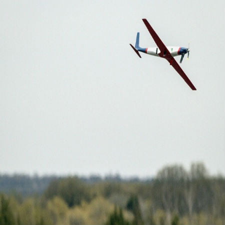
Drone Weather Watcher
Scroll down for video

Where Drones Come in
The Philippines has now started employing drones to survey farmlands and to help pin point storm risks and, in essence, brace themselves better of weather disasters. The Philippine Agriculture Department is making use of drones that are equipped with very advanced sensors to map the pictures of these large areas. The director of field operations of the department, Christopher Morales, said the unmanned aircraft is capable of flying over and monitoring an area of up to 600 hectares a day.
“Before, we were just concentrating on reports of our local program and counterparts. Usually it might be overestimated or underestimated. By the use of drones, we have a scientific tool to analyze this data and provide appropriate interventions,” Morales shared.
The information gathered by the drones can assist farmers in deciding what actions to take to prepare for storms. Morales said the drones are very efficient and can even be used right before big storms hit.

sUAS News
Morales said, “In the future, and if the investments of the government will come in, we will use these in the typhoon-prone areas also. So that a day or two before the typhoon (has made) landfall in the Philippines, we can approximate or do an estimation of pre-disaster assessment so we can plan ahead and respond accordingly.”
At the time, in the Philippines, they are experiencing one of the driest periods on record, and this is in parts due to the strong El Niño weather conditions. Therefore, the government must work hand in hand with private companies to develop a prototype drone, preferably one with a GPS tracking device, that can be used for cloud seeding to force the rains. Morales noted that using drones for this specific reason will save a lot of lives. Two years ago, one worker died during a cloud seeding operation, so the government plans to deploy full agricultural drone teams across the Philippines as soon as possible.
Watch the video below